活断層・古地震研究報告 第3号 トップへ
牛首断層南西部地域の活動履歴調査 (2) -トレンチ調査結果 (速報)-
宮下由香里・吉岡敏和・桑原拓一郎・苅谷愛彦・藤田浩司・千葉達朗
牛首断層活動履歴調査の一環として、断層南西部地域の2個所で合計3個のトレンチ掘削調査を実施した。その結果、牛首断層の最新活動イベントは、8〜9世紀以降であること、また、約9500yBP以降に、複数回のイベントが発生した可能性があることが明らかとなった。
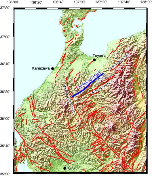
第1図
第1図. 牛首断層位置図。断層線の位置は新編『日本の活断層』による。陰影図の作成には国土地理院発行の国土数値情報50mメッシュ (DEM) を使用。
Fig. 1. Index map and detailed distribution of the Ushikubi fault. Digital Map 50 m Grid (Elevation) of the Geographical Survey Institute is used for arranging the basal topographic map.
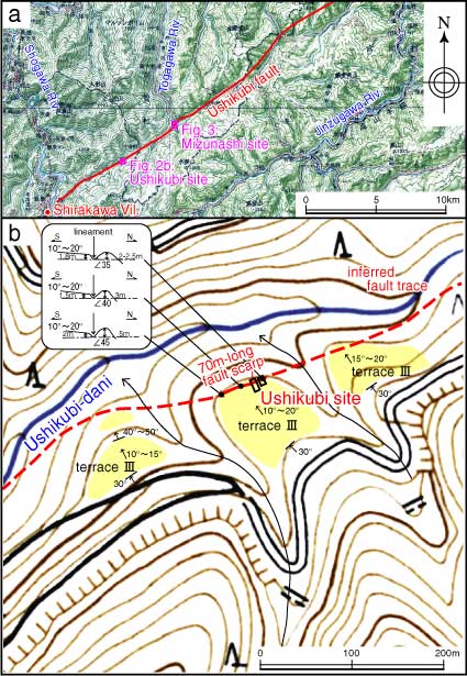
第2図
第2図. 牛首トレンチサイトの位置と周辺の地形。
Fig. 2. Detailed topographic map showing the trace of the Ushikubi fault and Ushikubi trench site, Shirakawa Village.
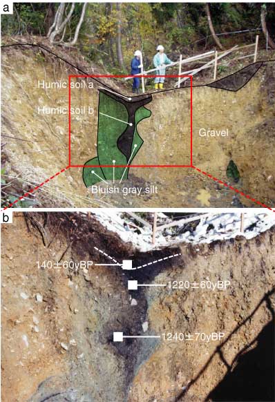
第3図
第3図. 牛首トレンチA北東壁面の写真と14C年代値。
Fig. 3. Photographs of the northeast wall of the Ushikubi trench A and 14C ages.