活断層・古地震研究報告 第3号 トップへ
牛首断層南西部地域の活動履歴調査 (1) -地形地質調査結果-
宮下由香里・吉岡敏和・桑原拓一郎・苅谷愛彦・松浦一樹・吉村実義・高瀬信一
牛首断層活動履歴調査の一環として、南西部20kmの範囲で地形地質調査を実施した。その結果、空中写真判読によって高いランクのリニアメントが認められた地域では、基盤岩中の破砕帯の幅も広い傾向が認められた。
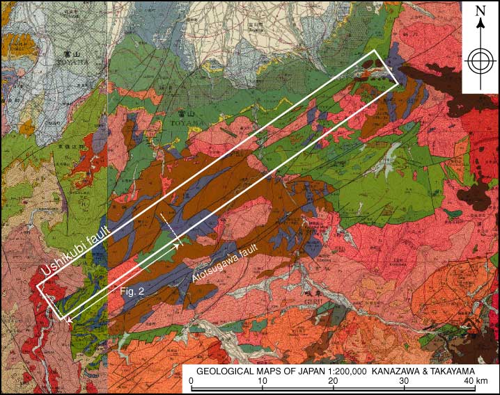
第1図
第1図. 牛首断層位置図。基図は産業技術総合研究所地質調査総合センター発行の20万分の1地質図幅集 (画像) 金沢、高山を使用。
Fig. 1. Location of the Ushikubi fault. Geological maps of Japan 1:200000 (Images) of the Geological Survey of Japan, AIST is used for arranging the background map.
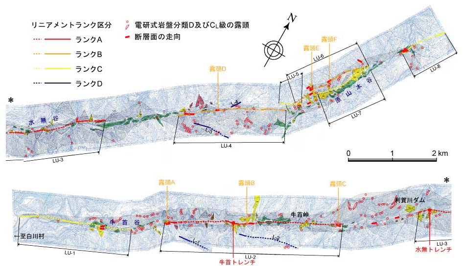
第2図
第2図. リニアメントのランク (確実度) と基盤岩中の断層破砕帯の幅との関係。
Fig. 2. Correlation between certainty of lineaments and width of fracture zone in basement rocks.