活断層・古地震研究報告 第2号 トップへ
サンアンドレアス断層系ヘイワード断層におけるジオスライサー調査
遠田晋次・中田 高・奥村晃史・高田圭太・原口 強
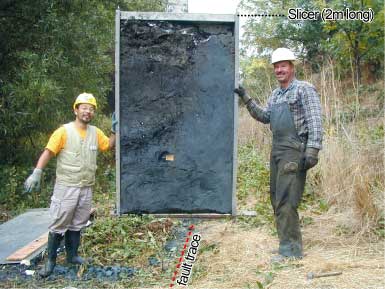
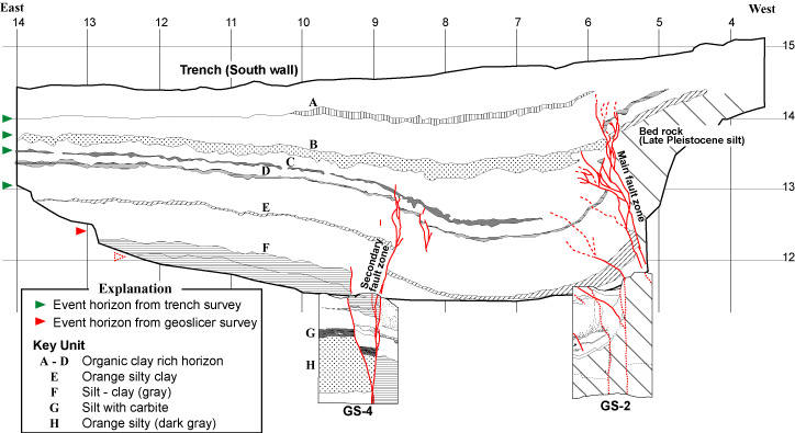
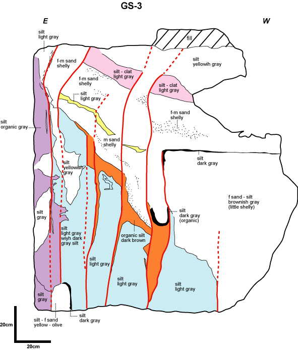
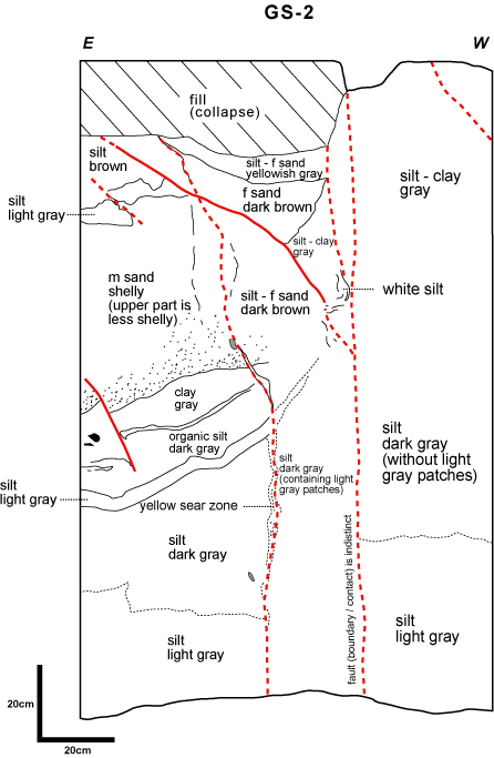
アメリカ合衆国地質調査所と共同でヘイワード断層の地層抜き取り調査を実施した (第1図)。調査では、先行実施したトレンチの底面からジオスライサーを打ち込み、 地表下約5mまでの地質構造を明らかにした。(第2図) 抜き取った試料には、トレンチ壁面に露出する断層の深部延長部と過去のイベントを示す"切った覆われた"の 関係が認められた。(第3図) これにより、トレンチ調査では解明できなかった西暦1400以前のイベントの検出に成功した。
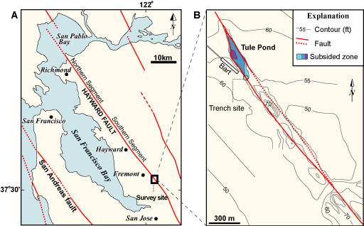
第1図
第1図. 調査地域の概観図および空中写真。A : サンフランシスコ湾岸地域の活断層分布、B : 調査地域周辺の詳細図、C : フリーモント市街地の空中写真。空中写真は U.S. Geological Survey: 16 Jun. 1993 を使用。断層位置は、Lienkaemper (1992) による。
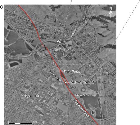
Fig. 1. Index map of the survey site. A: active faults around San Francisco Bay, B: detailed map of the survey site, C: aerial photograph of Fremont. The aerial photograph was taken by the U. S. Geological Survey in 16 June, 1993. The fault traces are after Lienkaemper (1992).
第2図
第2図. 活断層トレンチ調査へのジオスライサーの適用。A : 調査のながれ、B : シャッタープレートの打ち込み、C : 抜き取られた試料断面 (GS-2)。
Fig. 2. Application of geoslicer to active fault research at conventional trench sites. A: flow of the survey, B: driving a geoslicer from the bottom of the trench, C: an extracted geoslice showing layers displaced by faults.
A 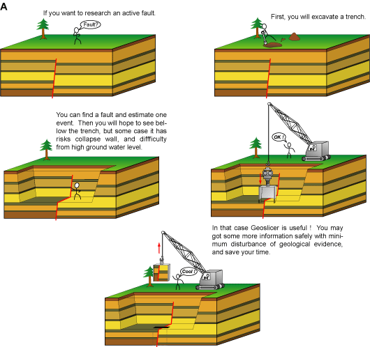
B 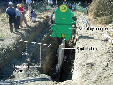
 C
C
↑ 画像をクリックすると拡大します。
第3図
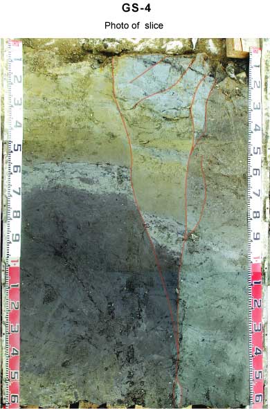
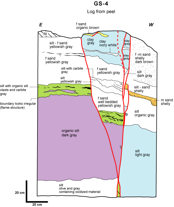
第3図. USGSトレンチ壁面とジオスライサー試料断面の合成図。
Fig. 3. Composite log of the USGS trench and geoslices.
| GS-4 | GS-3 | GS-2 |
|---|---|---|
| 試料写真 試料断面のスケッチ |
試料断面のスケッチ | 試料断面のスケッチ |