Cover and Back cover
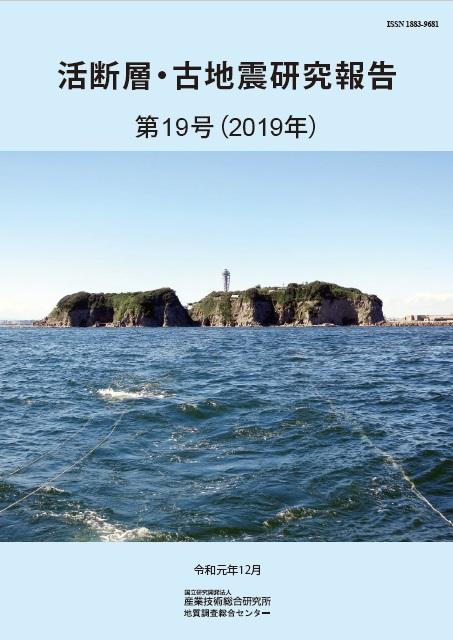
Cover:
South side view of Enoshima Island from the ship under the reflection seismic survey
The F3 fault is distributed under the sea and continues to the Kinugasa and Kitatake faults
comprising the Miura Peninsula fault group. A sound source system (left side) and
receiver cable (right side) are slightly visible below the sea surface. For details, see Sato
and Abe in this volume (p. 1-11).
(Photo by Tomoyuki Sato)
Back cover:
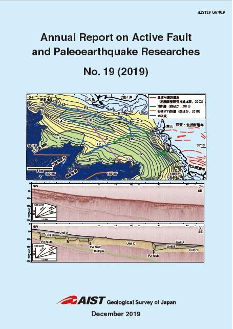
(a) Geological map showing the distribution of the faults in the northeastern part
of Sagami Bay.
(b) Reflection cross section along the purple line in the Fig. a.
(c) Interpretation for the Fig. b.
For details, see Sato and Abe in this volume (p. 1-11).
(Figures by Tomoyuki Sato)
Geological Survey of Japan, AIST
- About GSJ
- Our Activities
- Purchase guide
- Publications and Database
- Geological Hazards
- Learning and Education
- GSJ Database Collection
- Collection of links