Cover and Back cover
Cover:
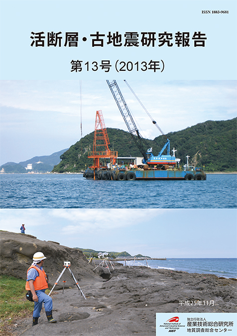
Top: Drilling survey of the Nosaka Fault off Mihama Town, Fukui Prefecture
The Nosaka Fault bounding Tsuruga Plain on the southwest extends into the Sea of Japan at Sata, Mihama Town. In September, 2013, drilling was conducted on both sides of the offshore fault. The photo is a survey ship used for drilling. An orange installation is a drilling tower that has extracted sediment samples 39 m long in total. (Photo: Yuichi Sugiyama)
Bottom: Lidar measurement for coastal topography in the Kenbutsu coast, Boso Peninsula.
We aim to reveal a formation process of marine terrace by repeatedly measuring for emerged shoreline topography related to the 1703 Genroku and the 1923 Taisho earthquakes and for present wave-cut-topography. (Photo: Masanobu Shishikura)
Back cover:
Left:
Giant peel obtained from a trench wall across the Okaya fault along the Itoigawa-Shizuoka tectonic line active fault system
Top right :
Setting up of the giant peel in the exhibition hall of the Geological Museum
Bottom right :
Peel of the AD896 Jogan’s tsunami deposit, taken in Sendai plain

Geological Survey of Japan, AIST
- About GSJ
- Our Activities
- Purchase guide
- Publications and Database
- Geological Hazards
- Learning and Education
- GSJ Database Collection
- Collection of links