Cover and Back cover
Cover:
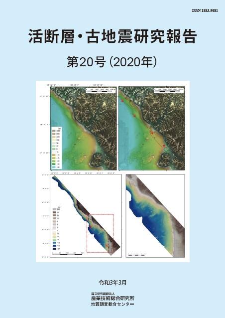
Airborne LiDAR Bathymetry (ALB) on coastal sea area of the Kikugawa fault zone
Topography on sea-land interface area of the middle segment of the Kikugawa fault zone, Yamaguchi Prefecture. Elevation tints maps are compiled from DEMs of Geospatial Information Authority of Japan (GSI), Japan Coast Guard (JCG) and Japan Hydrographic Association (JHA) (above left), DEMs of GSI, JCG and JHA plus the results of ALB measurements (above right), the results of ALB measurements (bottom left and right). In all figures, grayed-out Red Relief Image Maps are superimposed. Red arrows indicate inferred fault traces.
Back cover:
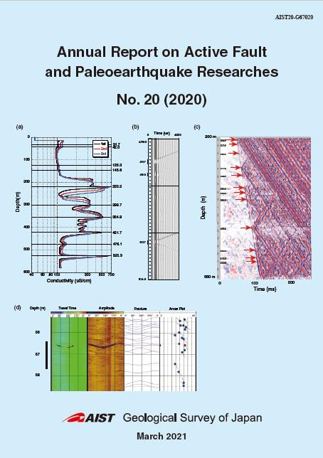
(a) Result of fluid electrical conductivity logging at the Kumano-Isozaki Observation site (ICU)
(b) Waveforms obtained by sonic logging at the Nishio-Zenmyo Observation site (NSZ)
(c) Result of hydrophone VSP at the Niihama-Kuroshima Observation site (NHK)
(d) BHTV image at the Susaki-Otani Observation site (SSK)
For details, please refer to Kiguchi and Kuwahara (pp. 1-78).
Geological Survey of Japan, AIST
- About GSJ
- Our Activities
- Purchase guide
- Publications and Database
- Geological Hazards
- Learning and Education
- GSJ Database Collection
- Collection of links