Fukutoku-Oka-no-Ba submarine volcano information top
Release date: November 9, 2021 (JST)
Status and impacts of pumice rafts around Okinawa Island (Part2)
From October 28 to 30, researchers from the Geological Survey of Japan (GSJ, AIST) conducted another survey of the Fukutoku-Oka-no-Ba pumice rafts around Okinawa. Many pumice rafts were observed around the main island of Okinawa from the plane on October 28 (Photo 1). Observations made during the survey revealed that a combination of factors such as coastal topography, wind conditions, and ocean currents determine which areas of the island are affected by the pumice rafts (Photo 2). In some cases, there is significant variation in the amount of pumice deposited at adjacent beaches. Furthermore, the amount of pumice along the natural coast varies every day due to changes in the ebb and flow of the tide, wind strength and direction, and ocean currents. Pumice that has drifted into man-made harbours, however, is not easily moved to other locations despite variations in the ocean and wind conditions. The total thickness of the pumice trapped in harbours was measured to be about 10 to 20 cm. This value can be used as a guide when calculating the volume of pumice floating in a harbour.
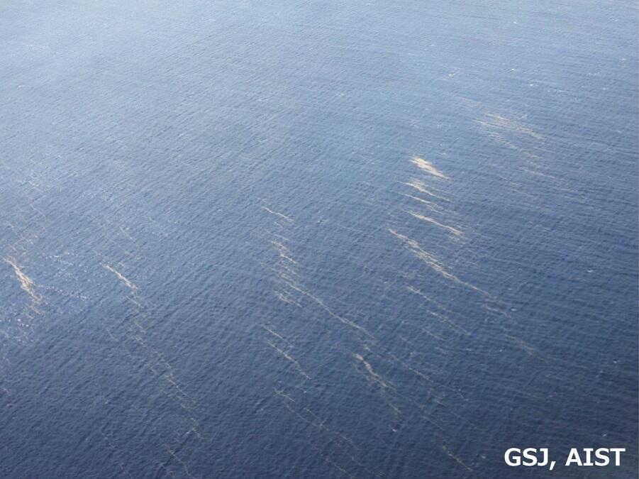
Photo 1 Pumice rafts (beige streaks) in the southern part of the main island of Okinawa seen from a plane (October 28). A large number of pumice rafts were observed drifting in the sea around the main island of Okinawa.
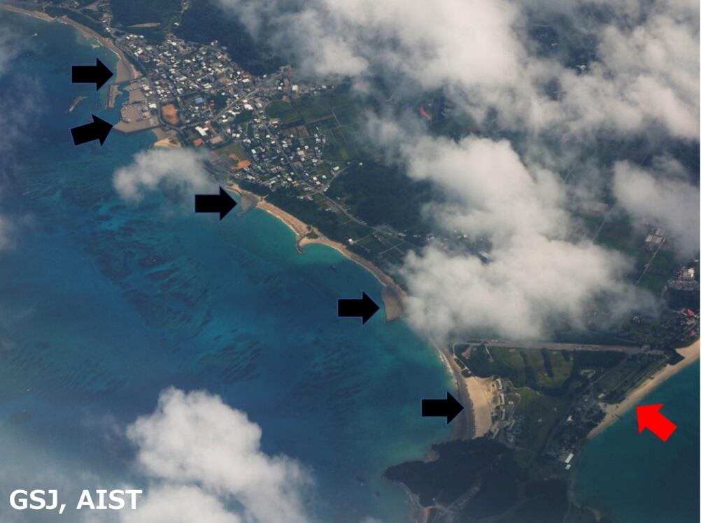
Photo 2 The western coastline of Kunigami Village, from Hentona fishing port (upper left) to Okuma Beach (lower right) as seen from a plane (October 28). Even in adjacent areas, the amount of pumice that has been washed ashore varies greatly. Black arrows indicate locations on the coastline that are distinctly gray because large amounts of pumice have been washed ashore, and the red arrow indicates a beach where no pumice has been deposited. The combination of coastal topography, winds, and ocean currents divides the coast into such areas where pumice is deposited or not.
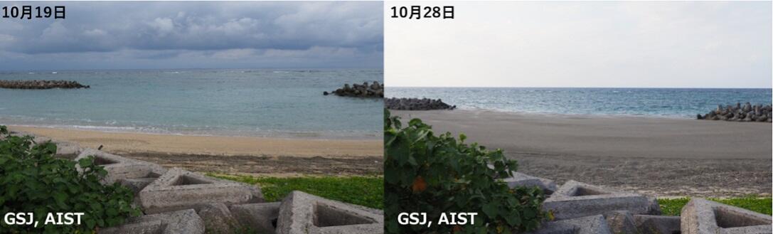
Photo 3 Comparison of the coast of Oganeku, Ogimi Village on October 19 and 28. The amount of pumice washed ashore increased markedly between October 19 and 28. According to interviews with the locals, however, the amount of pumice washed ashore on the natural coast changes greatly every day due to the ebb and flow of the tide, and variable wind conditions and ocean currents.
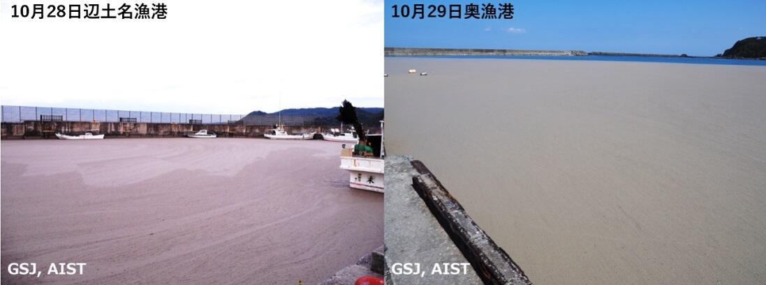
Photo 4 Pumice trapped within the Hentona fishing port (left) and the Oku fishing port (right) in Kunigami Village. Unlike along the natural coast, pumice that drifts into harbours becomes trapped and does not move back easily into the open sea despite changes to ocean and wind conditions. The thickness of the floating layer of pumice in the harbour was measured and found to be about 10 to 20 cm.
IEVG (Research Institute of Earthquake and Volcano Geology)