1:50,000 Quadrangle Geological Map of “IKEDA”
-The geology of the area where a world-class fault system runs through -
Summary of the AIST Press Release on Apr. 19, 2021
>>Japanese
The Median Tectonic Line (MTL) is one of the largest active fault systems in the world running from eastern Kyushu to Kanto and geologically divides the southwestern Japan into the Inner and Outer zones. GSJ’s latest 1:50,000 Quadrangle Geological Map called “IKEDA” covers the southwestern part of the Sanuki Mountains, along whose southern edge runs the MTL. In the area, different types of contemporaneous (Late Cretaceous) rocks adjoin each other here: the Ryoke Complex (felsic plutonic rocks and high-temperature/low-pressure metamorphic rocks) and the Izumi Group (sedimentary rocks) in the north of the MTL and the Sanbagawa Complex (low-temperature/high-pressure metamorphic rocks) in the south. Such geological structure is often seen in a subduction zone and provides important clues to understand the tectonic history of the Japan Islands. The map also depicts the distribution of active faults and landslide areas, which will be helpful in developing disaster mitigation measures and projects such as public works and building construction.
The map “IKEDA” is available from distributing agents below:
https://www.gsj.jp/Map/EN/geology4-13.html
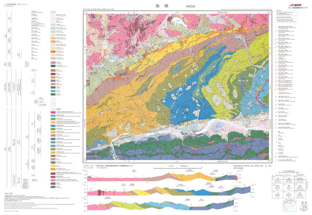
Fig. 1. 1:50,000 Quadrangle Geological Map of “IKEDA”
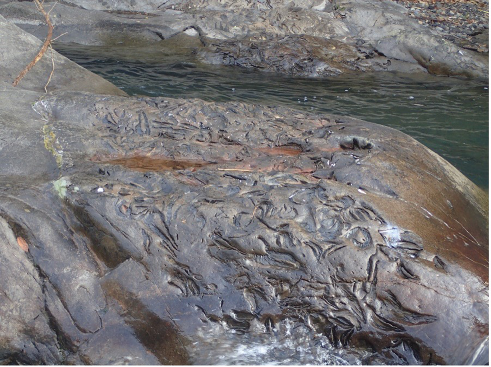
Fig.2. A fossil bed in the Izumi Group.