Development of high-resolution elevation tiles applicable to 3D mapping
-GSJ has started online delivery of the Seamless Elevation Tiles-
Summary of AIST Press Release Oct. 1, 2020
>>Japanese
The Integrated Geo-information Research Group led by NISHIOKA Yoshiharu, which has been conducting the research on the utilization of elevation data with the Geospatial Information Authority of Japan (GSI), converted elevation data into the PNG Elevation Tiles and made them available on the web as the Seamless Elevation Tiles (https:/gbank.gsj.jp/seamless/elev/, currently available only in Japanese).
Elevation data are utilized in many situations such as creating a three-dimensional map and hazard simulation. Thanks to recent progress of survey techniques, huge amount of high-resolution data has become available on the Internet. However, most of them are for professional use and require specific skills and expertise to process them. The Research Group converted the 1-meter mesh elevation data released by Hyogo Prefecture in January 2020 and some others into the PNG Elevation Tiles, which enables fast operation of 3D visualization on a website even for general users.
As the tile sets of Hyogo Prefecture are created from highly precise elevation data, they are expected to be an effective tool in creating a new service to tackle regional issues, for example, developing anti-disaster measures against floods or landslides.
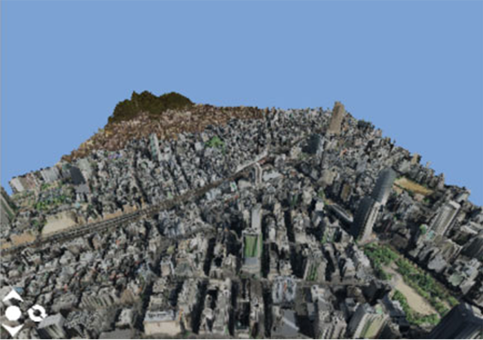
Fig. 1. 3D model of Sannomiya district, Kobe, created with the Seamless Elevation Tiles
(photo tiles are provided by GSI).
The elevation data used here include the height of objects on the earth such as buildings and trees.