The map tells the reason why fossils of a dinosaur were found there
- “Toba”, 1:50,000 quadrangle geological map -
Summary of AIST Press Release September 14, 2017
>>Japanese
The Geological Survey of Japan (GSJ) has published the 1:50,000 quadrangle geological map of Toba (Takayuki Uchino et al., the Research Institute of Geology and Geoinformation) (Fig.1).
In the area, located in the eastern part of the Kii Peninsula, there are five major geological belts that form the basement of the Japanese Islands: the Sambagawa, Northern Chichibu, Kurosegawa, Southern Chichibu and Shimanto belts from northwest to southeast. These belts mainly comprise Jurassic–Cretaceous accretionary complexes and shallow-marine deposits. In compiling the map based on the results from field surveys and laboratory works, the stratigraphic and tectonic framework of the area has been revised, and the geological process and tectonic history have been reconstructed.
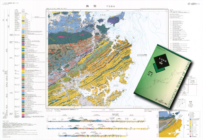
Fig. 1. Geological map of Toba
In addition to these new scientific findings, the map also explains geological riddles in the area. In 1996, dinosaur’s fossils were discovered in Toba City, but it has not been known why they were found there. The answer is given by restoring the local tectonic history with the map. The fossils were discovered in narrowly distributed shallow-marine sediments called the Matsuo Formation in the Kurosegawa Belt. The process is as follows: 1) the shallow-marine deposits covered the Jurassic–Cretaceous accretionary complexes; 2) the geological belts on both sides of the Kurosegawa Belt uplifted, and whence the shallow-marine deposits on the belts were denuded; 3) fossils were preserved in a zone which escaped the denudation (Fig. 2).
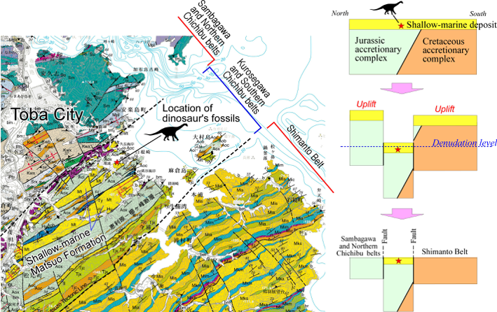
Fig. 2. Tectonic scheme illustrating how the dinosaur’s fossils were preserved in Toba City