The geological history of Japanese Islands recorded in northernmost part of the Japan Alps
-“Tomari”, 1:50,000 quadrangle geological map -
Summary of AIST Press Release August 28, 2017
>>Japanese
The Geological Survey of Japan (GSJ) has published the 1:50,000 quadrangle geological map of “Tomari”, working with Nagoya University (constructed by Makoto Takeuchi of Nagoya University, Ryuta Furukawa of the Caldera Volcano Research Group, GSJ et al.). The Tomari district is located at the border between Toyama and Niigata Prefectures where the Japan Alps (Hida Mountains) is extending toward the Japan Sea. The geological map is constructed based on original survey combined with zircon U-Pb isotope dating. Detailed examination of the lithology and structure of strata ranging from Ordovician to Holocene has provided the important information to elucidate the whole history of the Japanese Archipelago. It not only satisfies scientific interest but also is helpful in the areas of geological hazard mitigation, tourism and developing an outreach program.
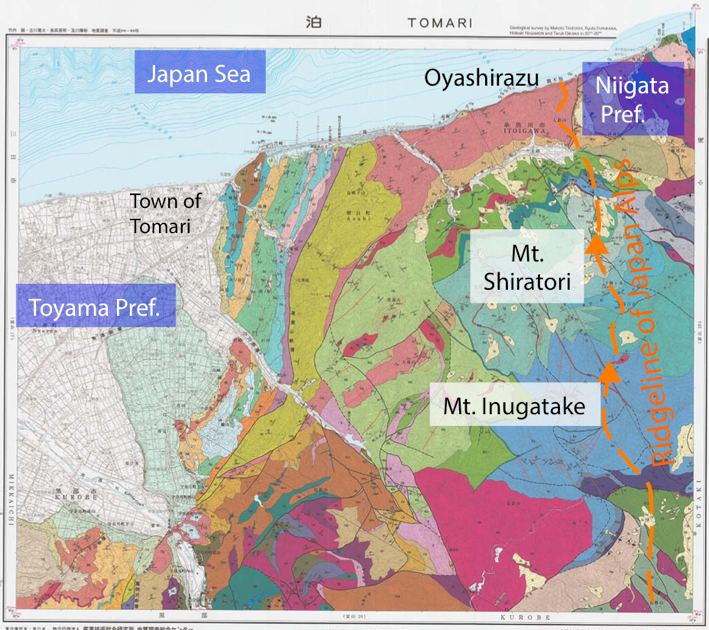
1:50,000 geological map of “Tomari”
The map has been published in August 2017 and is available from commission agents. For details, see the URL below.