Hundred million years that have shaped today’s Kagawa Prefecture
- “Kan-onji”, 1:50,000 quadrangle geological map -
Summary of AIST Press Release on July 24, 2017
>>Japanese
The Geological Survey of Japan (GSJ) has published the 1:50,000 quadrangle geological map of “Kan-onji”, compiled by Atsushi Noda (Stratigraphy and Tectonics Research Group) and his colleagues, on July 2017. This is the first 1:50,000 geological map that covers Kagawa Prefecture, Shikoku.
In Shikoku, the north side of the Median Tectonic Line (MTL) has quite different geology from the south side. Kan-onji is the area of the typical geology in northern Shikoku: a hundred-million-year-old plutonic rocks covered by marine sedimentary rocks of the Late Cretaceous, Neogene volcanic rocks, and Quaternary fluvial deposits. The map provides not only clues to understand the geological history of the area but also important information for disaster mitigation. It is also expected to be used in site selection and infrastructure construction.
GSJ is currently conducting surveys in the adjacent area of Ikeda till 2019 and will continue to publish 1:50,000 geological maps in Shikoku and other regions.
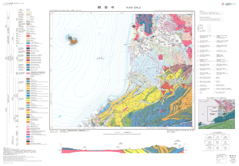
1:50,000 geological map of “Kan-onji”