Detection of vehicles buried by a landslide using a drone with an electromagnetic (EM) sensor
- Drone EM system successfully identified the location -
Summary of AIST Research Results on June 5, 2017
>>Japanese
Yuji Mitsuhata (Director, Research Institute for Geo-Resources and Environment) and Takumi Ueda (Exploration Geophysics Research Group) have developed an airborne exploration method using a drone mounted with an EM sensor for detecting buried vehicles in a landslide under the NEDO (New Energy and Industrial Technology Development Organization) project. They cooperated with Field Robotics Research Group, AIST, and three private companies (ENROUTE CO., LTD, Hitachi, Ltd., and Yachiyo Engineering Co., Ltd.).
They have conducted an experiment at a test site and succeeded to determine the location of a car buried at the depth of 1.5 meters in the ground. Since drones can fly at low altitude over inaccessible narrow or danger areas, this new method is expected to be helpful in speeding up rescue of victims trapped in a car in a landslide mass. Researchers continue the experiments under conditions close to actual surroundings aiming at its practical use.
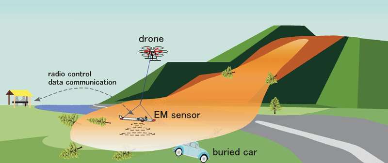
Schematic illustration to show how the drone EM system detect the trapped car