Publication of the Gravity Map of Wakayama District (Bouguer Anomalies)
- 1:200,000 Gravity Map Series, No.32 -
Summary of AIST Research Results on June 23, 2017
>>Japanese
The Gravity Map of Wakayama District (Bouguer Anomalies) at a scale of 1:200,000, compiled by Ayumu Miyakawa (Geophysics Research Group) and his colleagues together with Kyoto University, Okayama University of Science, and Tottori University, has been published by the Geological Survey of Japan (GSJ) in March 2017.
It is the 32nd detailed Bouguer anomaly map in GSJ’s Gravity Map Series, compiled with gravity data measured at 14,828 stations that include 221 newly surveyed ones. It is released only online for the first time. The map, expository note, and newly obtained gravity data can be downloaded from GSJ’s website (https://www.gsj.jp/Map/EN/geophysics.html) and users can build a purpose-designed map choosing data depending on their needs.
As the information in gravity maps reflects underground geological structures, they are mainly used for disaster prevention and exploration of natural resources. The map is also expected to be useful in developing tourism resources such as in geoparks.
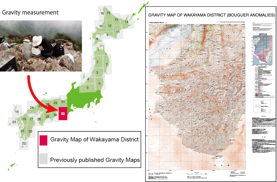
Gravity Map of Wakayama District (Bouguer Anomalies)
Publication details
Miyakawa, A., Nawa, K., Murata, Y., Komazawa, M., Makino, M., Murakami, F., Okuma, S., Nakamura, K., Akamatsu, J., Nishimura, K., Nishida, R., and Noguchi, T. (2017) Gravity Map of Wakayama District (Bouguer Anomalies), Gravity Map Series, no. 32, Geological Survey of Japan, AIST.