Quick Imaging of possibly affected areas by volcanic eruption, tsunami, etc.
-High-speed handling of elevation data on the Internet-
Summary of AIST Research Results on April 28, 2017
>>Japanese
Mr. Yoshiharu Nishioka, leader of the Integrated Geo-information Research Group, and his colleagues have developed “PNG Elevation Tile”, a new format that enables quick handling of elevation data on the Internet. The format, which is compatible with most web map applications like Google Maps, has been employed in the maps provided by the Geospatial Information Authority of Japan. As it is useful for real-time map data editing and numerical simulation, it is expected that the format will promote utilization of elevation data in a wide range of areas such as infrastructure building, disaster-prevention, and tourism.
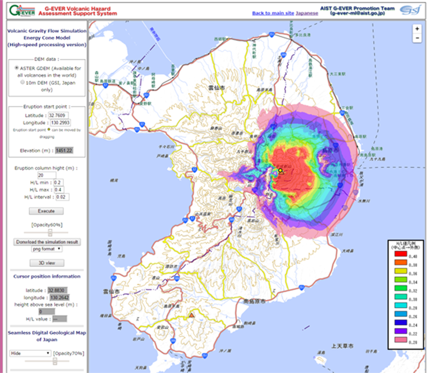
An example of numerical simulation using the PNG Elevation Tile
Pyroclastic flow reaching area at Mt. Unzen simulated by the G-EVER volcanic hazard assessment support system
(http://g-ever1.org/quick/index_en.html)