Water Environment Maps
-For Future Groundwater Use-
Last Updated: April 13, 2021
Surveys and studies of groundwater have a long and rich history in Japan. Water Environment Maps combine past knowledge with the results of the most recent surveys and studies of groundwater. Water Environment Maps include the details of macroscopic groundwater flow, water quality, and water temperature distribution in basins and plains. GSJ has been publishing these groundwater maps for nearly 60 years.
Protecting high quality groundwater
Water Environment Maps show the relationship between aquifers and geological structures, and groundwater flow systems—in other words, where the groundwater comes from and where it goes. These types of information can help us understand that groundwater is common property of the community and decide what we need to focus on to protect the groundwater resource. There is an ever-increasing need for a better understanding of local groundwater flow systems, and Water Environment Maps will play increasingly important roles in this regard.
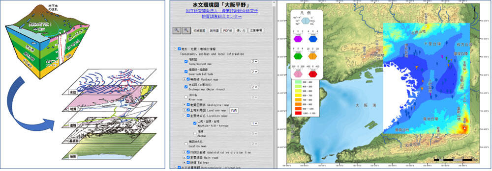
Left: Water Environmental Maps display many kinds of local hydrological information in layers. Right: A screenshot of Water Environmental Map of Osaka Plain, showing the dissolved ion components in an aquifer.