Remote Sensing: calibration, validation and its utilization
-Monitoring the Earth by Eye of Science-
Last Updated: April 13, 2021
We are studying satellite remote sensing, which is used in many fields such as exploration of metals and fuel resources, and monitoring of the global environment. Our research focuses on the development of new sensors for a satellite, calibration and validation of massive acquired data and their efficient management, and the creation of various thematic maps and their practical utilization.
ASTER* is one of the sensors on board the NASA’s flagship earth observing satellite, and we, collaborating with other research institutes of AIST, have been heavily involved in all aspects from its development to its use in space. We are also involved in developing HISUI (the Hyperspectral Imager Suite), a hyperspectral sensor with 185 spectral bands on board the ISS (International Space Station) whose main purpose is resource exploration. In addition, we are developing calibration methods of satellite images based on cross-calibration of various data obtained from the satellite sensors for the Earth and the observation of the Moon.
To ensure the data quality, we make real-time observation in the desert or on the dry lake abroad where the satellite makes observation and compare both the data. The difference between them represents the degree of sensitivity degradation of the sensor in space and enables us to assess the data quality and calibrate the system.
As part of our task in developing the database and image-delivery technology, we are implementing the international geographic information standards for Internet usage. These data are used to create a global map of urban areas and the ASTER seamless satellite image mosaic of the entire Earth in simulated natural color. Our work also includes the research into a worldwide volcano monitoring service. All these data are being made public as they become available and are provided as a regular service.
Annotations:
* ASTER: Advanced Spaceborne Thermal Emission and Reflection Radiometer
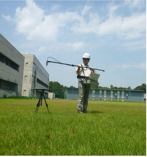
Vicarious calibration campaign
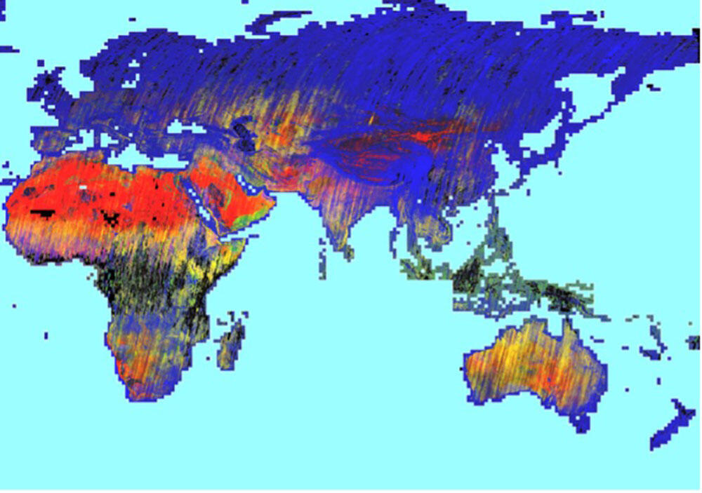
Global geologic index map