For the short to medium forecast of Nankai Trough megathrust earthquakes
Last Updated: April 13, 2021
In the Nankai Trough, which develops from off the southern coast of Shikoku to the Suruga Bay, massive earthquakes of magnitude 8 class have occurred repeatedly once in a hundred to two hundred years. More than seventy years have passed since the latest Tonankai earthquake (M7.9) in 1944 and the Nankai earthquake (M8.0) in 1946 occurred. The government of Japan assesses the probability of next massive earthquake of magnitude 8 to 9 occurring within the next 30 years at 70 to 80 percent and estimates the damage at over 169 trillion Japanese yen.
In the plate boundary at the depth of 30 to 40 km in the northern part of the possible focal area of the Nankai Trough earthquakes, slow slip events occur several times in one year. The possibility has been pointed out that, before a massive earthquake occurs, the source area of these events migrates to the focal area and their frequency and magnitude changes.
We have constructed 16 observation stations of groundwater and crustal strain to monitor the crustal activity for the next Nankai Trough megathrust earthquake. We also collaborate with the Japan Meteorological Agency (JMA) and the National Research Institute for Earth Science and Disaster Resilience (NIED) in exchanging real-time data to detect the slow slip events in the Nankai Trough area. We analyze slow slip events using the observed and provided data as well as develop the methods for the analysis. The results of our analysis are contributed to the evaluation of possibility of the megathrust earthquake issued by the Nankai Trough Earthquake Assessment Committee of JMA and the evaluation of the slow slips issued by the Earthquake Research Committee of the Headquarters for Earthquake Research Promotion. Our analytical method is used for the analysis in other institutes. In addition, our strainmeter data have been used by the JMA to constantly monitor the slow slip events along the Nankai Trough since June 2020.
We will carry on our research to improve the analytical technique of slow slip events to contribute to the national monitoring of the Nankai Trough area along with other organizations.
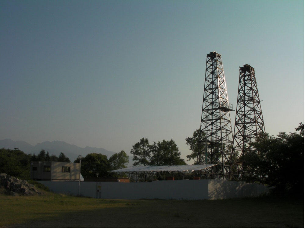
Fig. 1 Drilling rigs during constructing the Niihama observation station, Ehime Prefecture.
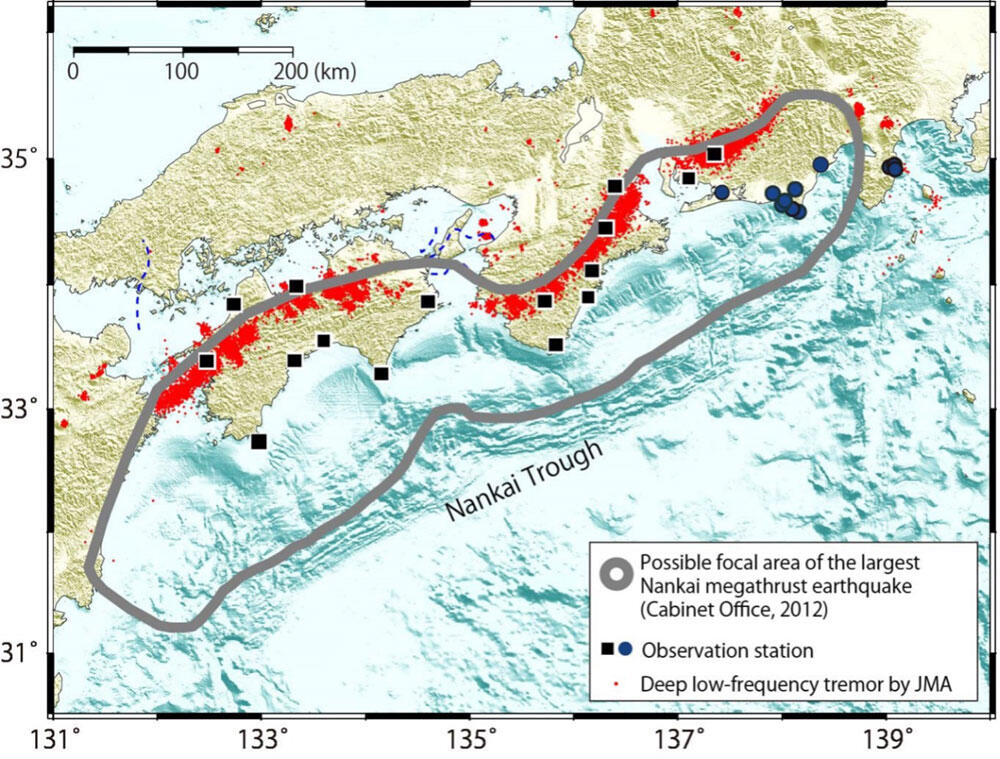
Fig. 2 AIST’s observation stations to monitor the Nankai Trough earthquakes.
■: Groundwater and strain, ●: Groundwater only
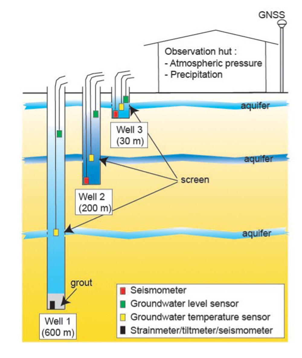
Fig. 3 Schematic illustration of an observation station (■ in Fig. 2) for groundwater and strain monitoring