Marine Geology Map
-To understand the area that makes up 90 percent of our national territory-
Last Updated: April 13, 2021
Understanding the marine geology around Japan
Japan, surrounded on all sides by sea, has 13 times larger ocean area than its own land, including its economic zone and extended continental shelves. In recent years, to utilize and manage this broad territory, there has been increasing emphasis on the geology and geological phenomena in these areas: earthquakes and tsunamis caused by offshore faults, deep-sea resources, characterization of seafloor basement for ocean development, long-term dispersion and accumulation of pollutants and others.
We compile the Marine Geology Map series as the basic information of the nation. They are compiled after long and exhaustive work: sample and data collection on board a survey ship for weeks followed by analyses in the laboratory. The Marine Geology Map series at the scale of 1:200,000 consists of two types of map for each area, namely a geological map and a sedimentological map. The former depicts the submarine stratigraphy and geological structure, and gravity and magnetic anomaly maps that depict deeper structure are included in the map. The latter shows the distribution of sediments on the seafloor, the thickness and sedimentation rate of the sedimentary layer, the sedimentation process, and the direction of sediment transportation based on the analysis of sediment samples.
We have completed a survey of all areas surrounding the four major Japanese islands and the marine area around the Nansei Islands (Ryukyu Islands), and maps are being published for these areas. From 2020, surveys of the area around the Tokara Islands, the archipelago located between Yakushima and Amami-Oshima, will start. Three areal maps will be published at the scale of 1:200,000 for this region, followed by the surveys and map compilation in the waters of the Okinawa Trough
Multiscale Marine Geological Information
The demand to provide the marine geological information about surrounding waters of Japan at different scales is growing to be used in ocean development, environmental assessment, resource exploration, etc. To respond it, we promote the acquisition of the marine geological information in higher resolution as well as the publication of fundamental marine information, i.e., the 1:200,000 Marine Geology Map series.
We have introduced the state-of-the-art deep-towed equipment with boomer/sparker and jointly developed streamer cable so as to obtain high resolution profiling images from shallow to deep waters using acoustic reflection technique. With this deep-towed system, we try to obtain undiscovered geological information such as the distribution patterns of the uppermost stratum and volcanic and tectonic history at middle to deep water zone. Besides, introducing other sonars and sensors, we obtain many types of data such as acoustic images of the seafloor, magnetic data, and the chemical composition of the water mass near the bottom.
We will promote our research of marine geological survey at different scales to respond to the request by the country and to contribute to the establishment of safe and secure society.
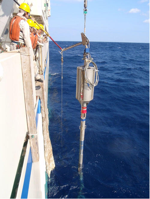
Marine sediment sampling using a gravity corer. Different types of samplers such as grab samplers and dredges are used in collecting marine sediment and rock sampling depending on the objects.
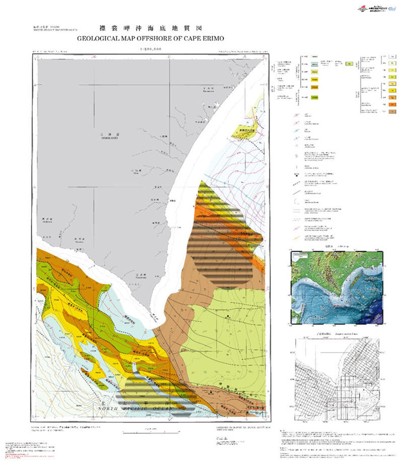
Marine geological map of Offshore of Cape Erimo, which is created mainly based on seismic reflection profiles. It shows the distribution of submarine strata and geological structure such as faults and folds.
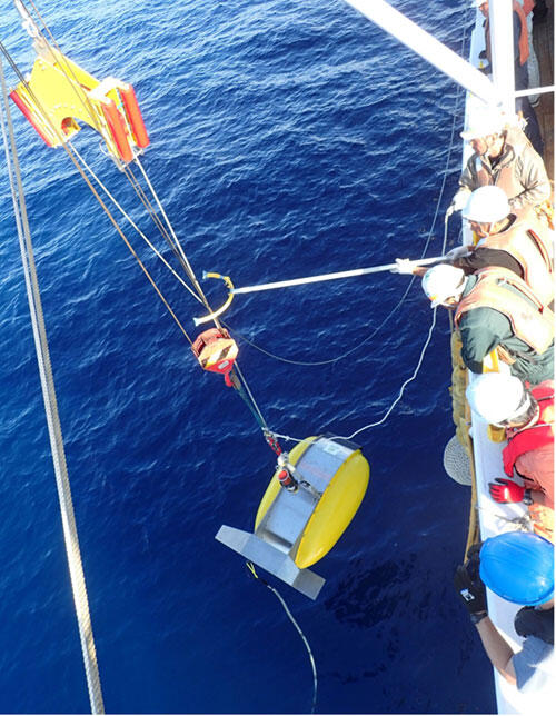
Deep Tow high-resolution Sub-bottom profiler: integrating with two acoustic sources remotely selectable depending on depth and/or bottom sediment, the apparatus can acquire high-resolution acoustic profiles in mid- to deep-sea area