2nd Floor
2nd Floor:2nd and 3rd Exhibition Rooms
click red texts to show guides
2nd Exhibition Room
Periodic Table of the Elements
You can see the periodic table of the elements with mineral specimens including each element, adding to the information of their utilities, in the place near the entrance in the 2nd exhibition room.
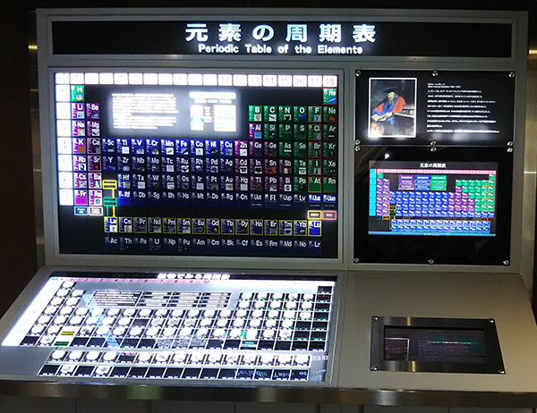
Submarine 'Chimneys'
Submarine hydrothermal deposits form at mid-oceanic ridges by the activity of magma beneath the ridge. Seawater infiltrating in the ridge is superheated by the hot magma, begins to circulate through fractures, reacts with its surrounding rocks, and becomes saturated with metallic elements. On reaching the ocean floor, the hot and pressurized water is forcibly injected into the cold seawater and the metallic elements precipitate out as sulfide minerals on the ocean floor. The deposits form mound and chimney structures, such as those shown in the glass case.
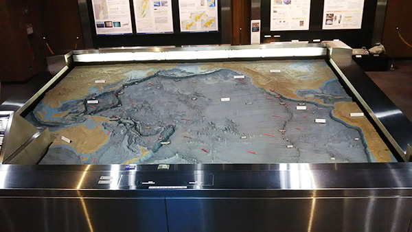
Model of the Pacific Ocean Floor
In the center of the 2nd exhibition room is a model of the Pacific Ocean floor. Red lights indicate the East Pacific Rise and other mid-oceanic ridges, and blue lights indicate trenches. Magma is ejected along the oceanic ridges and solidifies on contact with seawater to form new crust, which is then carried away from the mid-oceanic ridges as part of the Pacific plate at rate of 3-10 cm per year. Portions of the Pacific plate subduct from the trenches to beneath the continent.
3rd Exhibition Room
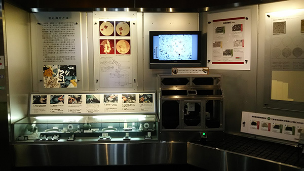
What is a Rock Thin Section?
This display explains processes for making thin sections. A thin section is a rock fragment ground to a thickness of about 0.03 mm and glued on the glass plate for the microscopic observation of the texture of the rock. Making and observing thin sections need professional skills. You can see photographs of the textures of granite and several other rocks taken under microscope.
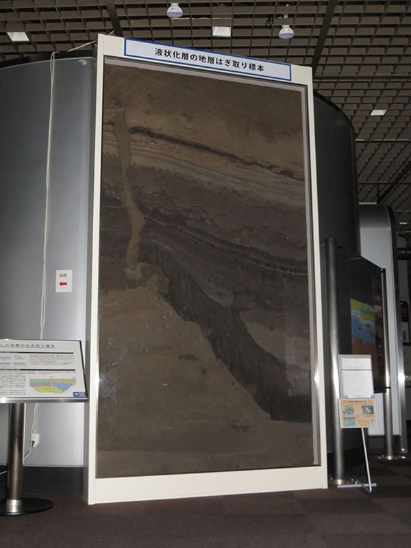
Liquefaction of Soils by Earthquakes (Peeled Stratum)
Liquefaction is a phenomenon wherein a water-saturated and loosely compacted sandy layer tempolarily loses its strength due to earthquake shaking, causing the layer to behave like liquid. The lower Tone River region suffered damages as a result of liquefaction in the 2011 Tohoku Earthquake. This is a peeled cross section taken from a trench survey conducted in Kozaki Town, Chiba Prefecture, which clearly illustrates the distinctive subsurface structure after liquefaction. A part of the dredged sand layer at the bottom of the panel was liquefied, penetrated the layer of soil above, and formed a sand dike.
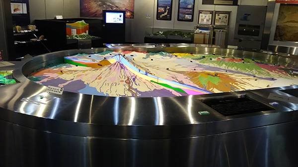
3-dimensional Model of Mts. Fuji and Hakone
In the center of the 3rd exhibition room are 3-dimensional model of Mts. Fuji and Hakone. Press the button and you can see geological cross sections of the volcanoes. The base of Mt. Fuji consists of two older volcanoes.: Mts. Komitake and Kofuji. The present Mt. Fuji has been active since Mt. Kofuji ceased volcanic activity at about 17,000 years ago and erupted most recently in 1707 to form a new crater, Mt. Hoei. Compared with Mt. Fuji, Mt. Hakone is more complicated in structure and of more silica-rich in rock type, composed primarily of dacite and andesite. Mt. Hakone experienced two stages of caldera formation, followed by the development of dacite lava domes.