|
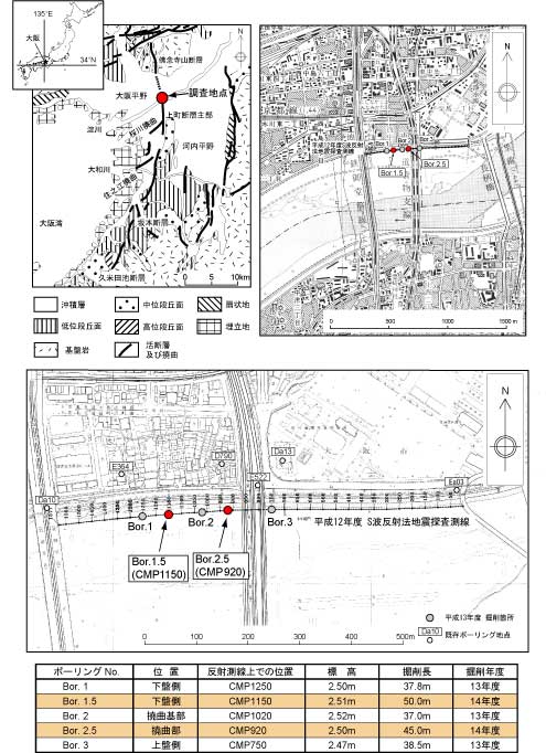
第1図.大阪市新淀川河川敷における追加ボーリング掘削位置と平成12年度に実施したS波反射法地震探査の測線.国土地理院発行2.5万分の1地形図大阪東北部,大阪西北部を使用.
Fig. 1. Map showing the locations of Bor. 1.5 and Bor. 2.5 cored in the 2002 fiscal year and S-wave seismic reflection survey conducted in the 2000 fiscal year on the northern bank of the Shin Yodo-gawa River, Osaka City.
|