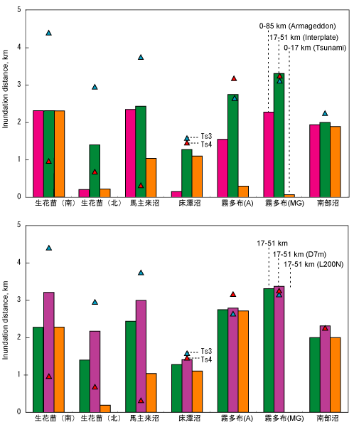
Fig. 2. Maximum inundation distance from coast line of tsunami deposits (Ts3 and Ts4) and simulation. Top: Effect of fault width (Armageddon, interplate and tsunami earthquakes). Bottom: Effects of fault length (300 km vs. 200 km on the Nemuro side) and slip amount (D 5m vs 7m).