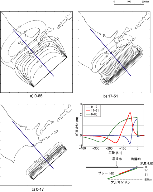
Fig. 1. Crustal deformation pattern of various fault models. (a) Map view of Armageddon (0-85) model, (b) Map view of Interplate earthquake (17-51), (c) Map view of Tsunami earthquake (0-17). (d) Cross section along blue lines shown in (a)-(c). Counter interval is 0.2 m, solid curves indicate uplift while dashed one subsidence.