< 前のページへ戻る
|
|
北海道東部,十勝海岸南部地域における17世紀の津波痕跡とその遡上規模の評価
|
|
|
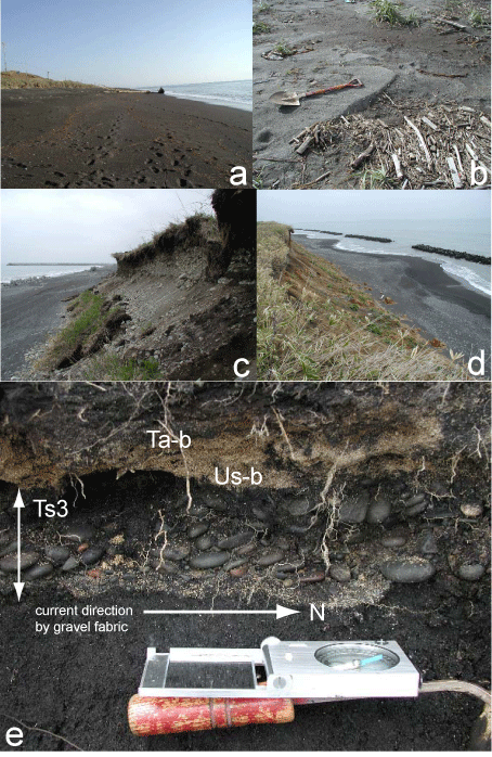
第2図.調査地域の野外写真.(a)Ba測線付近の海浜の状況,(b)Ho測線で見られる越流によって生じたウオッシュバーファンの産状, (c,d)海食崖と歴舟川起源の礫層(最終氷期)の産状,および(e)As測線のファブリックを示すイベント堆積物の産状.
Fig. 2. Photographs shownig field occurences. (a) shoreline area of line Ba, (b) small washover fans at line Ho, (c & d) ocurrences of coastal cliffs and their gravel beds of Rekifune River during LGS, and (e) an event deposit with gravel fabric at line As.
|
 |
|