北海道東部,十勝海岸南部地域における17世紀の津波痕跡とその遡上規模の評価
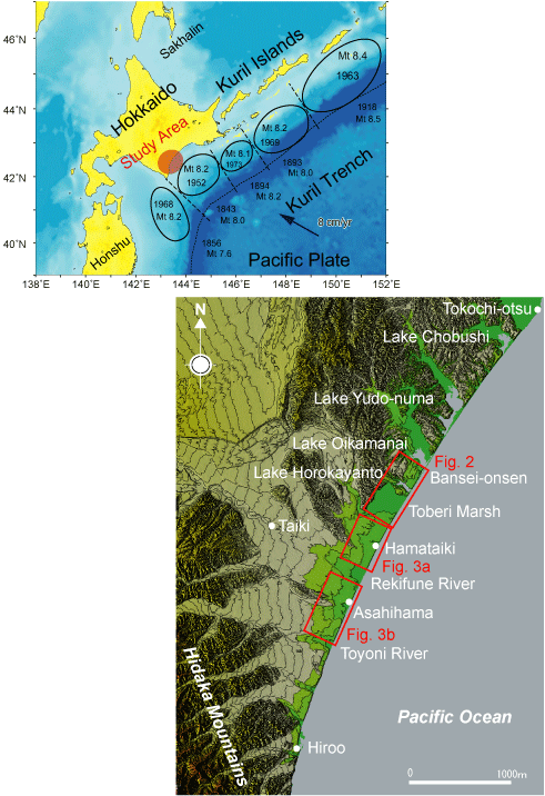
第1図.千島海溝のテクトニクス,海溝型地震の余震域(上)と十勝海岸の調査地域位置図. Fig. 1. Tectonic map around Hokkaido showing earthquake sources of the Kuril subduction zone (above) and index map of the study areas (below).