2000年鳥取県西部地震に伴う地殻変動の測地測量調査
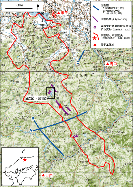
第1図.調査地域の概要. 国土地理院発行200,000分の1地勢図「松江および高梁」を使用. Fig. 1. Locality map of the study area.