Unzen videos
Geological Survey of Japan, AIST
This is a collection of video clips taken by staff of the Geological Survey of Japan, AIST.
- Please cite this report as: Miyagi, I., Kawanabe, Y., Takada, A., Sakaguchi, K., Takarada, S. (2007) A Collection of Unzen Video Clips. GSJ Open-file Report no. 469, Geological Survey of Japan, AIST
INDEX;
[go top]
Videos
[go top]
May 27, 1991

- Lava dome and pyroclastic flows from EDM station (9 A.M., May 27, 1991). EDM stand for Electro-optical. Distance Measurement. Video taken by Y. Kawanabe.

- Aerial observation of the lava dome (11 A.M., May 27, 1991). Video taken by Y. Kawanabe.

- Aerial observation of the lava dome (11 A.M., May 27, 1991). - Ash cloud from the pyroclastic flows and lava dome. Video taken by Y. Kawanabe.

- Aerial observation of the lava dome (11 A.M., May 27, 1991). - Growing lava dome can be seen from the break of the cloud. Video taken by Y. Kawanabe.

- Unzen volcano and EDM operation (7 P.M., May 27, 1991). - The EDM caught the deformation of the summit area from several days before the emergence of lava dome. In the last sequence, cloud of pyroclastic flows is seen. Video taken by Y. Kawanabe.
[go top]
May 28, 1991

- Mud rain and ash fall deposit (10 A.M., May 28, 1991). - Volcanic ash produced by pyroclastic cloud sometimes fell down as mud rain. Video taken by Y. Kawanabe.
[go top]
May 29, 1991

- Pyroclastic flow and rock fall from the lava dome (3 P.M., May 29, 1991). Video taken by Y. Kawanabe.

- Pyroclastic flow (3 P.M., May 29, 1991) - A pyroclastic flow moved down along the Mizunashi River viewed from Kitakamikoba which was destroyed by a larger pyroclastic flow on June 3. Video taken by Y. Kawanabe.
[go top]
May 30, 1991

- Trace of a pyroclastic flow along the Mizunashi River (5 P.M., May 30, 1991). -The dense portion of the pyroclastic flow flowed down along the lower part of the river, but pyroclastic surge went straight and destroyed trees. Video taken by Y. Kawanabe.
[go top]
June 1, 1991

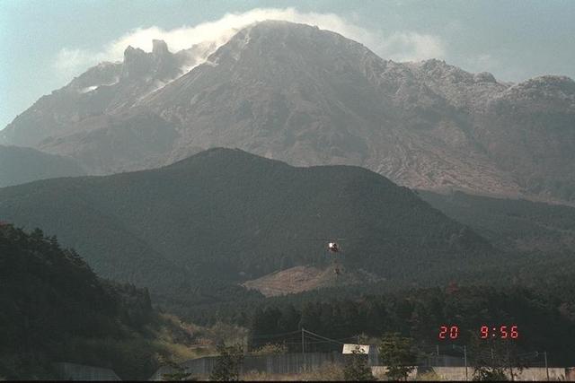
- Growing lava dome and volcanic gas emission (4 P.M., June 1, 1991). - The eastern half of the dome collapsed and killed 43 people on June 3, 1991. Video taken by Y. Kawanabe.
[go top]
June 3, 1991

- Pyroclastic flow viewed from the road along the southern bank of the Mizunashi River (4 P.M., June 3, 1991). Video taken by A. Takada.
[go top]
June 4-7, 1991

- Aerial view of the lava dome and pyroclastic flow (Early June, 1991). Video taken by SVO?
[go top]
June 8, 1991

- Mayuyama, lava dome and ash cloud of a pyroclastic flow (June 8, 1991). - video taken by A. Takada.
[go top]
June 9, 1991

- Aerial view of the hazard area of the June 8, 1991 pyroclastic flow (June 9, 1991). Video taken by K. Sakaguchi.
[go top]
Appendix
Pictures taken by I. Miyagi 8 years after the eruption.
[go top]
The Summit Area
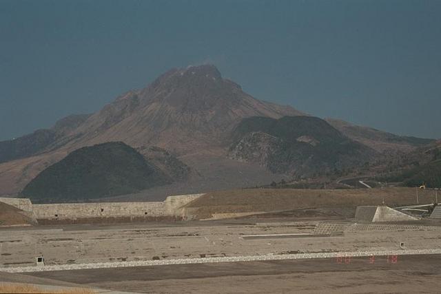
- Distant view from Mizunashi River (left), from Nita Path (middle), and from the Kureishibaru district (right).
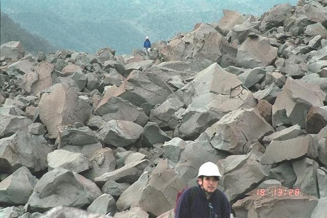
- Pile up of auto-brecciated lava near the summit area (left). Mafic inclusion in Heisei lava (right).
[go top]
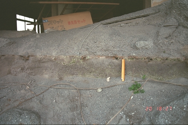
Damage by Pyroclastic flow
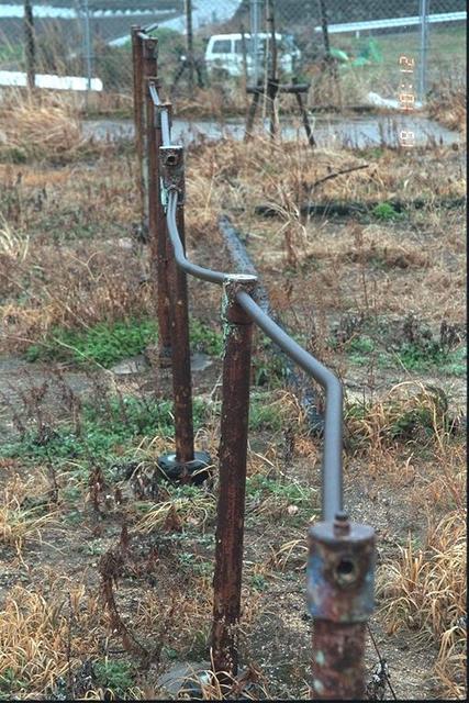
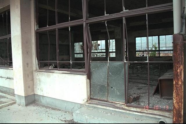
- Bent horizontal bars (left) and a damaged school building (right) of Oonokoba elementary school.
[go top]
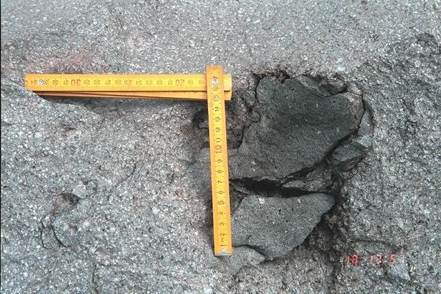
Damage by Mudflow
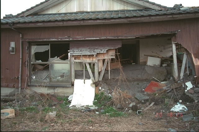
- A damaged private house by mudflow.
[go top]
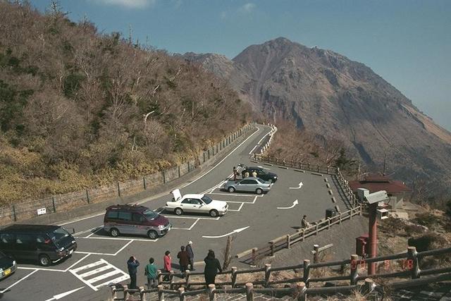
QuickTimeVR
- Near the summit area (left). At the north slope of about 900 m a.s.l., covered by pyroclastic deposits (right).
# Please install QuickTime software if needed.