牛首断層南西部地域の活動履歴調査(2)−トレンチ調査結果(速報)−
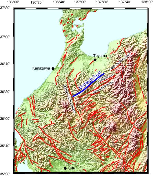
Fig. 1. Index map and detailed distribution of the Ushikubi fault. Digital Map 50 m Grid (Elevation) of the Geographical Survey Institute is used for arranging the basal topographic map.