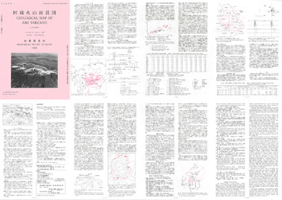
Geological Map of Volcanoes 4
Aso Volcano
 | |
| Series | Geological Map of Volcanoes |
| No. | 4 |
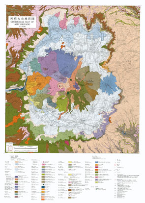
| Map Name | GEOLOGICAL MAP OF ASO VOLCANO |
| Author | Koji ONO and Kazunori WATANABE |
| Publication year | 1985 ( 4th printing, copy:2012) |
| Scale | 1:50,000 |
| Publisher | Geological Survey of Japan (Geological Survey of Japan, AIST) |
| Price | ¥1,210 ( Purchase Guide ) |
| Prefecture | Kumamoto |
| Size | B2(728mm×515mm) |
| Downloads | Raster(JPEG, GeoTIFF) data, Vector data, Explanatory Text(PDF) |
 | |
| Series | Geological Map of Volcanoes |
| No. | 4 |
| Map Name | GEOLOGICAL MAP OF ASO VOLCANO |
| Author | Koji ONO and Kazunori WATANABE |
| Publication year | 1985 ( 4th printing, copy:2012) |
| Scale | 1:50,000 |
| Publisher | Geological Survey of Japan (Geological Survey of Japan, AIST) |
| Price | ¥1,210 ( Purchase Guide ) |
| Prefecture | Kumamoto |
| Size | B2(728mm×515mm) |
| Downloads | Raster(JPEG, GeoTIFF) data, Vector data, Explanatory Text(PDF) |
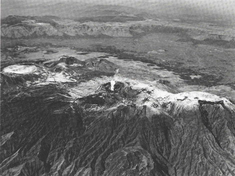 |
| Central part of Aso Volcano viewed from the southeast. Naka-Dake active crater is seen at the center, to the right are Naka-Dake summit and Taka-Dake, above it to the left are Ojo Dake, Kishima Dake, Kusasenri-ga-hara and Eboshi Dake. Beyond Aso Dani valley is the northwest rim of the caldera in the background. |