 | |
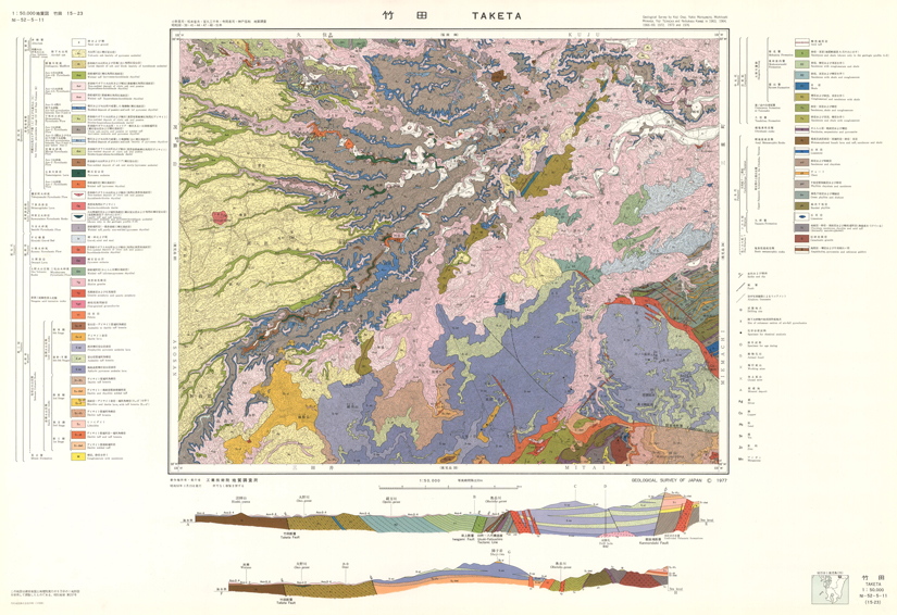
| Series | Quadrangle Series 1:50,000 |
| No. | 15 [KAGOSHIMA]-023 |
| Map Name | TAKETA |
| Explanatory | Geology of the Takeda District |
| Author | Koji ONO, Yukio MATSUMOTO, Michitoshi MIYAHISA, Yoji TERAOKA and Nobukazu KAMBE |
| Publish Year | 1977 |
| Publisher | Geological Survey of Japan |
| Price | out of stock |
| Prefecture | OITA, KUMAMOTO |
| Size | @790mm×@550mm |
| Download | Geological Map (Raster, GeoTIFF, KML, Vector data), Explanatory (PDF format) To this page |